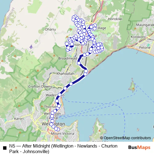
Courtenay Place - Stop A ➞ Johnsonville West - Mcclintock Street (near 87)
Route Path (Streets & Roads)
Schedules and stops for this route are published in GTFS: metlink-org
Bus N5 FAQ
-
What time does the N5 bus start operating?
Services on the N5 - After Midnight (Wellington - Newlands - Churton Park - Johnsonville) bus start at 01:00 on Saturday, Sunday.
-
What time does the N5 bus stop working?
Services on the N5 - After Midnight (Wellington - Newlands - Churton Park - Johnsonville) bus stop at 03:50 on Saturday, Sunday.
-
Is there a N5 bus stop near me?
Click here to view the nearest N5 - After Midnight (Wellington - Newlands - Churton Park - Johnsonville) bus stop.
N5 (Wellington Buses)
The first stop of the N5 bus route is Courtenay Place - Stop A and the last stop is
Johnsonville West - Mcclintock Street (near 87). N5 (After Midnight (Wellington - Newlands - Churton Park - Johnsonville)) is operational during on weekends.
Additional information: N5 has 102 stops and the total trip duration
for this route is approximately 50 minutes.
See why over 2 million users trust and consider busmaps.com as the best public transport website. busmaps gives you Wellington Buses suggested routes, real-time bus tracker, line route maps in Wellington, and helps to find the closest N5 bus stops near you. No internet available? Download an offline PDF map and bus schedule for the N5 bus to take on your trip.