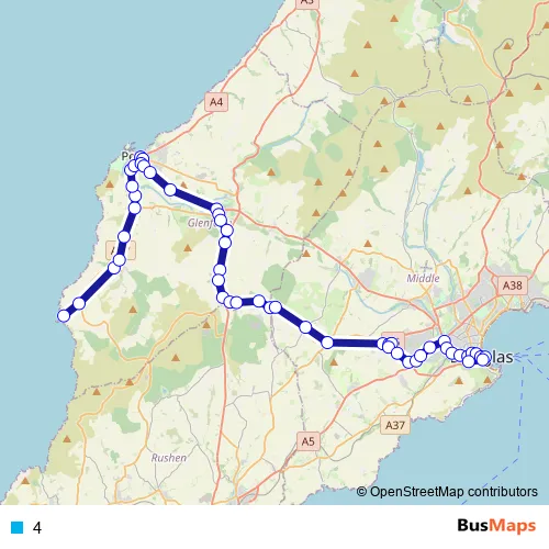
Niarbyl – Douglas, Banks Circus
Douglas, Banks Circus – Peel, Town Hall shelter, towards Douglas
Route Path (Streets & Roads)
Bus 4 FAQ
-
What time does the 4 bus start operating?
Services on the 4 bus start at 08:00 on Monday, Tuesday, Wednesday, Thursday, Friday, Saturday.
-
What time does the 4 bus stop working?
Services on the 4 bus stop at 18:54 on Monday, Tuesday, Wednesday, Thursday, Friday, Saturday.
-
Is there a 4 bus stop near me?
Click here to view the nearest 4 bus stop.
4 (Patrick Buses)
The first stop of the 4 bus route is Niarbyl and the last stop is Douglas, Banks Circus. 4 is operational during everyday.
Additional information: 4 has 51 stops and the total trip duration for this route is approximately 63 minutes.
See why over 2 million users trust and consider busmaps.com as the best public transport website. busmaps gives you Patrick Buses suggested routes, real-time bus tracker, line route maps in Patrick, and helps to find the closest 4 bus stops near you. No internet available? Download an offline PDF map and bus schedule for the 4 bus to take on your trip.
Similar Routes & Alternatives to 4
Looking for alternatives to 4? Discover the top-rated routes that share similar paths and stops. We've analyzed the network to bring you the best connections. Compare schedules and find the perfect backup plan or optimized route for your commute.