Pahto Public Passage Pahto Public Passage Bus
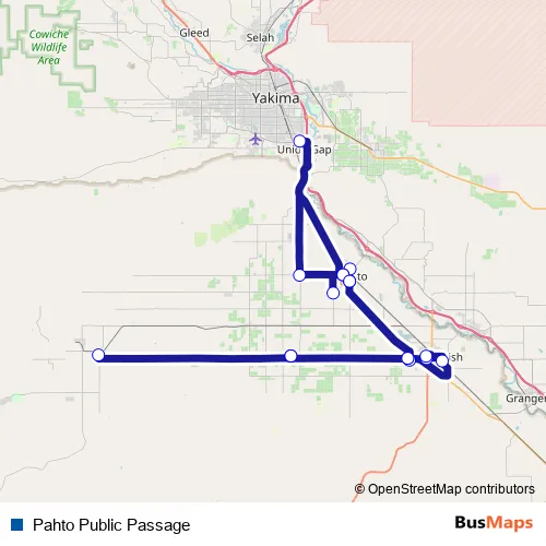
Cougar Den/White Swan High School – Union Gap Rite Aid at Valley Mall (9 E Valley Mall Blvd)
Union Gap Rite Aid at Valley Mall (9 E Valley Mall Blvd) – Yakamart (111 Fort Rd)
Route Path (Streets & Roads)
Bus Pahto Public Passage FAQ
What time does the Pahto Public Passage bus start operating?
Services on the Pahto Public Passage bus start at 06:50 on Monday, Tuesday, Wednesday, Thursday, Friday, Saturday, Sunday.
What time does the Pahto Public Passage bus stop working?
Services on the Pahto Public Passage bus stop at 10:35 on Monday, Tuesday, Wednesday, Thursday, Friday, Saturday, Sunday.
Is there a Pahto Public Passage bus stop near me?
Click here to view the nearest Pahto Public Passage bus stop.
Pahto Public Passage (Toppenish Buses)
The first stop of the Pahto Public Passage bus route is Cougar Den/White Swan High School and the last stop is Union Gap Rite Aid at Valley Mall (9 E Valley Mall Blvd). Pahto Public Passage (Pahto Public Passage) is operational during everyday.
Additional information: Pahto Public Passage has 15 stops and the total trip duration for this route is approximately 225 minutes.
See why over 2 million users trust and consider busmaps.com as the best public transport website. busmaps gives you Toppenish Buses suggested routes, real-time bus tracker, line route maps in Toppenish, and helps to find the closest Pahto Public Passage bus stops near you. No internet available? Download an offline PDF map and bus schedule for the Pahto Public Passage bus to take on your trip.